“Writing in a journal each day allows you to direct your focus to what you accomplished, what you’re grateful for and what you’re committed to doing better tomorrow.” -Hal Elrod
Day 45 ~ Distance: 15km, Climb: 950m, Cumulative: 1136km
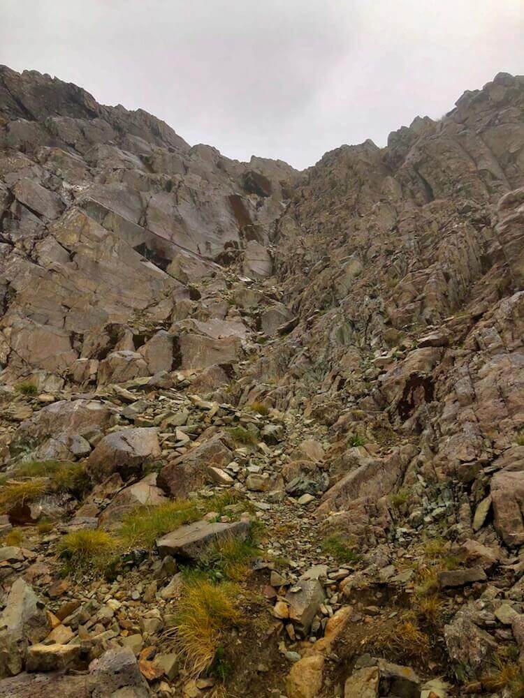
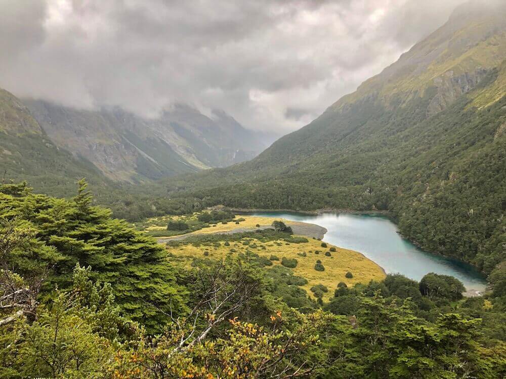
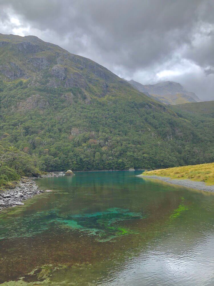
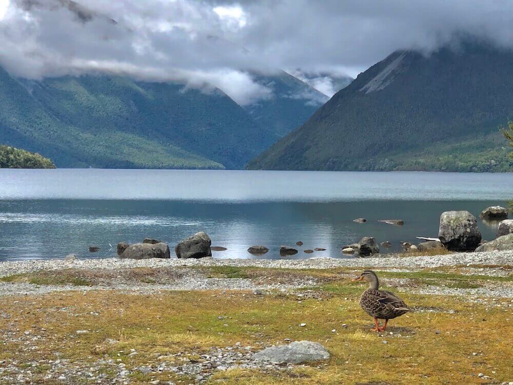
We woke up with the rain, it stops suddenly so we took our window to pack up. We started the day with a 800m climb. We had strong wind and driven rain, a part of the climb was more like scrambling. It was nice to have some fun scramble, even if the conditions were far from great. Once we got on Waiau Pass the wind and rain intensified and we were completely in the clouds, our visibility was very limited. I noticed my glove and wet rain jacket frosting. The descend wasn’t as steep as the ascent but none the less steep. We meet a group of hikers that were happy to see someone else on the trail. The trail first descended towards Lake Constance and afterwards Blue Lake. Blue Lake is known to have the world’s clearest freshwater. Even if we didn’t have the sun to see its nice colours, we had a taste of how translucent it is. We took a break from the rain at a hut there. Then pushed on to the next hut, that section was easier since we were in the forest and not exposed anymore. We spent the night in a hut, about a dozen people were already in but they had a fire started, it was warm and cozy.
We woke up with the rain, it stops suddenly so we took our window to pack up. We started the day with a 800m climb. We had strong wind and driven rain, a part of the climb was more like scrambling. It was nice to have some fun scramble, even if the conditions were far from great. Once we got on Waiau Pass the wind and rain intensified and we were completely in the clouds, our visibility was very limited. I noticed my glove and wet rain jacket frosting. The descend wasn’t as steep as the ascent but none the less steep. We meet a group of hikers that were happy to see someone else on the trail. The trail first descended towards Lake Constance and afterwards Blue Lake. Blue Lake is known to have the world’s clearest freshwater. Even if we didn’t have the sun to see its nice colours, we had a taste of how translucent it is. We took a break from the rain at a hut there. Then pushed on to the next hut, that section was easier since we were in the forest and not exposed anymore. We spent the night in a hut, about a dozen people were already in but they had a fire started, it was warm and cozy.

Day 46 ~ Distance: 26km, Climb: 820m, Cumulative: 1162km
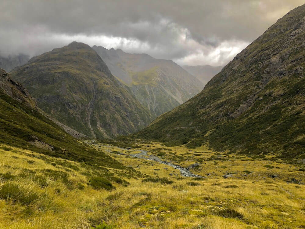
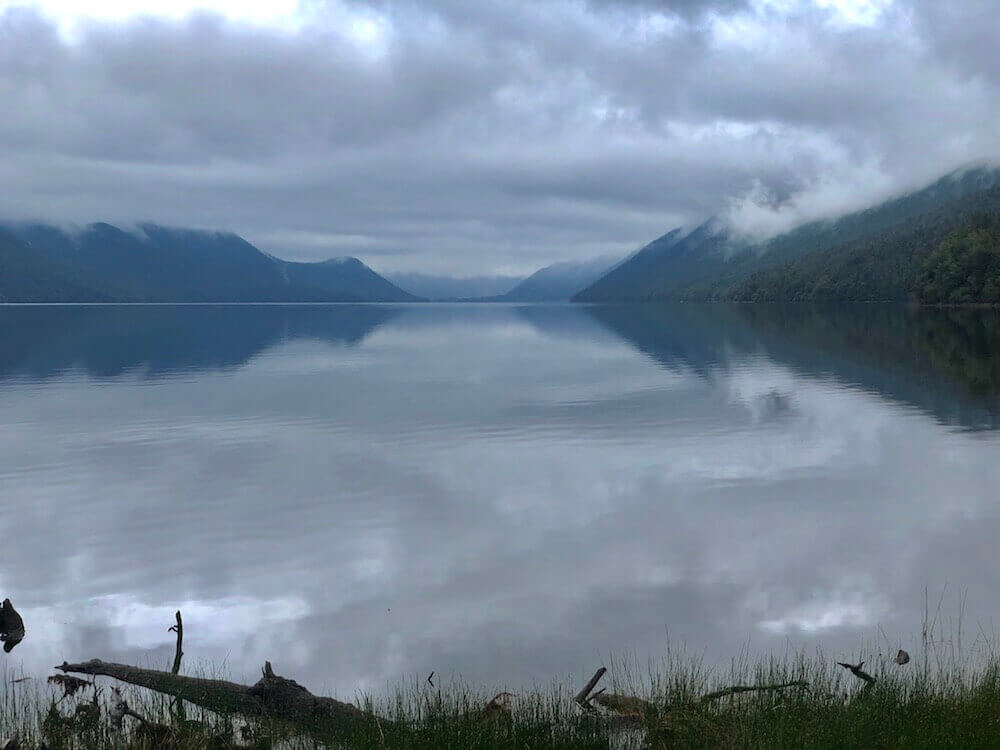
We decided to take a different route since it was supposed to be windy, rainy, and the clouds were still low. The actual trail was crossing another exposed saddle instead we took a trail in the valley. It was drizzling when we left the hut and we had drizzle on and off all day. We stopped at Sabine Hut which was beside Lake Rotoroa for a rain break and then pushed it to Speargrass Hut where we spent the night. Tomorrow some fresh food and a shower are waiting for us.
We decided to take a different route since it was supposed to be windy, rainy, and the clouds were still low. The actual trail was crossing another exposed saddle instead we took a trail in the valley. It was drizzling when we left the hut and we had drizzle on and off all day. We stopped at Sabine Hut which was beside Lake Rotoroa for a rain break and then pushed it to Speargrass Hut where we spent the night. Tomorrow some fresh food and a shower are waiting for us.
Day 47 ~ Distance: 12km, Climb: 100m, Cumulative: 1174km
We decided to sleep in since we only had 12km to get to town and could only check-in by 2pm at the lodge. After more rain, we arrived in town by 1pm, we went to take a look at the small general store of St Arnaud and bought a few things. Seeing its prices and limited varieties, we were happy we sent a box. We got our box at the same time then our room. We packed our food, we had lots of it. This upcoming section is the second longest and the one with the most climb. It is our last real challenge before the end...
We decided to sleep in since we only had 12km to get to town and could only check-in by 2pm at the lodge. After more rain, we arrived in town by 1pm, we went to take a look at the small general store of St Arnaud and bought a few things. Seeing its prices and limited varieties, we were happy we sent a box. We got our box at the same time then our room. We packed our food, we had lots of it. This upcoming section is the second longest and the one with the most climb. It is our last real challenge before the end...
Day 48 ~ Distance: 29km, Climb: 1000m, Cumulative: 1203km
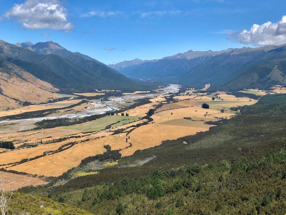
We started walking from St-Arnaud we had about 10km on the highway. We then climbed to a ridge to access the valley on the other side. The scenery seems drier here. It got hot during some of our climbs. We made it late at a hut, to our surprise no one was there. So we decided to take the luck we had and enjoy a small hut to ourselves.
We started walking from St-Arnaud we had about 10km on the highway. We then climbed to a ridge to access the valley on the other side. The scenery seems drier here. It got hot during some of our climbs. We made it late at a hut, to our surprise no one was there. So we decided to take the luck we had and enjoy a small hut to ourselves.
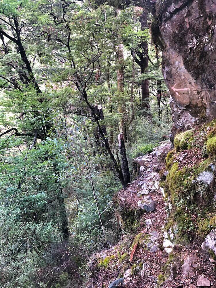
Day 49 ~ Distance: 17km, Climb: 1350m, Cumulative: 1220km
The hut had already a resident; a mouse. It was so friendly that it wanted to sleep with me. It ran across my arm, after that, we moved to the upper bunk beds and had a good rest of the night. The trail was rugged in part, the view was superb on the alpine part. Tomorrow is supposed to be pretty rainy and the following part is along a narrow river. If it rains hard, we will have to postpone since the river will flood and we have to cross it multiple times, let’s hope we can beat the rain and not be stuck here.
The hut had already a resident; a mouse. It was so friendly that it wanted to sleep with me. It ran across my arm, after that, we moved to the upper bunk beds and had a good rest of the night. The trail was rugged in part, the view was superb on the alpine part. Tomorrow is supposed to be pretty rainy and the following part is along a narrow river. If it rains hard, we will have to postpone since the river will flood and we have to cross it multiple times, let’s hope we can beat the rain and not be stuck here.
Day 50 ~ Distance: 7km, Climb: 100m, Cumulative: 1227km
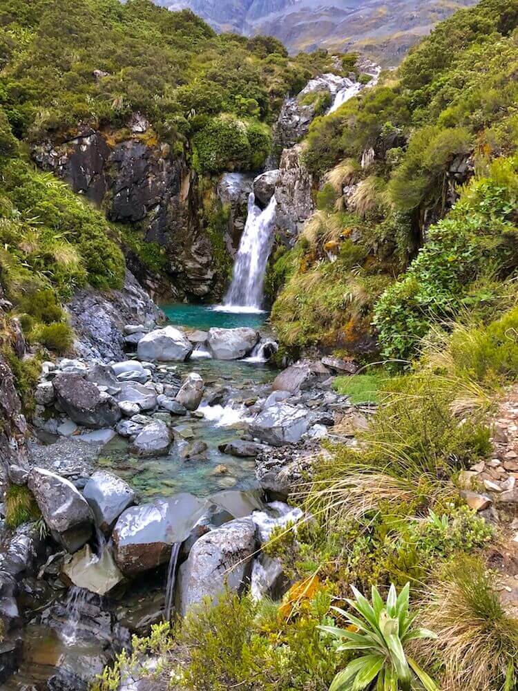
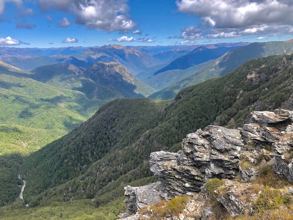
When we woke up, the weather looked ok to push on. We descended along the Wairoa River left branch, it was awesome. In some parts, the river looked more like a gorge or a canyon, with turquoise swimming pools. The trail was exposed at certain points, but we managed to make it to the next hut before the storm hit. Within a kilometre of the hut, my hiking partner stumbled upon a wasp's nest, we got about 8 stung in between us. We spent the rest of the day chilling while the storm hit hard all afternoon and evening.
When we woke up, the weather looked ok to push on. We descended along the Wairoa River left branch, it was awesome. In some parts, the river looked more like a gorge or a canyon, with turquoise swimming pools. The trail was exposed at certain points, but we managed to make it to the next hut before the storm hit. Within a kilometre of the hut, my hiking partner stumbled upon a wasp's nest, we got about 8 stung in between us. We spent the rest of the day chilling while the storm hit hard all afternoon and evening.
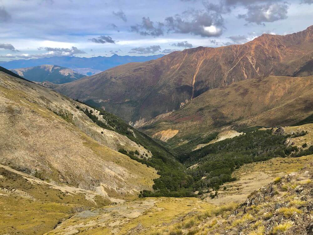
Day 51 ~ Distance: 15km, Climb: 1420m, Cumulative: 1242km
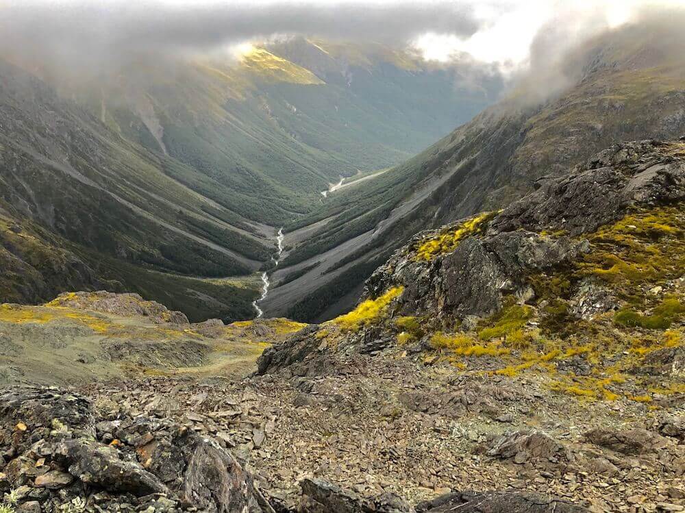
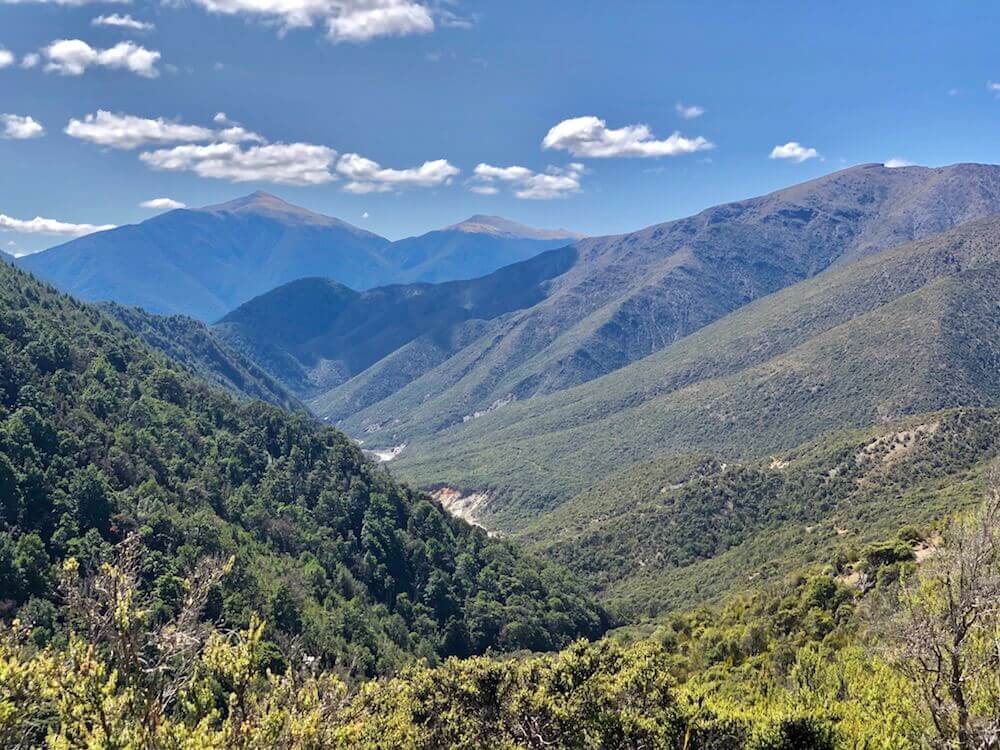
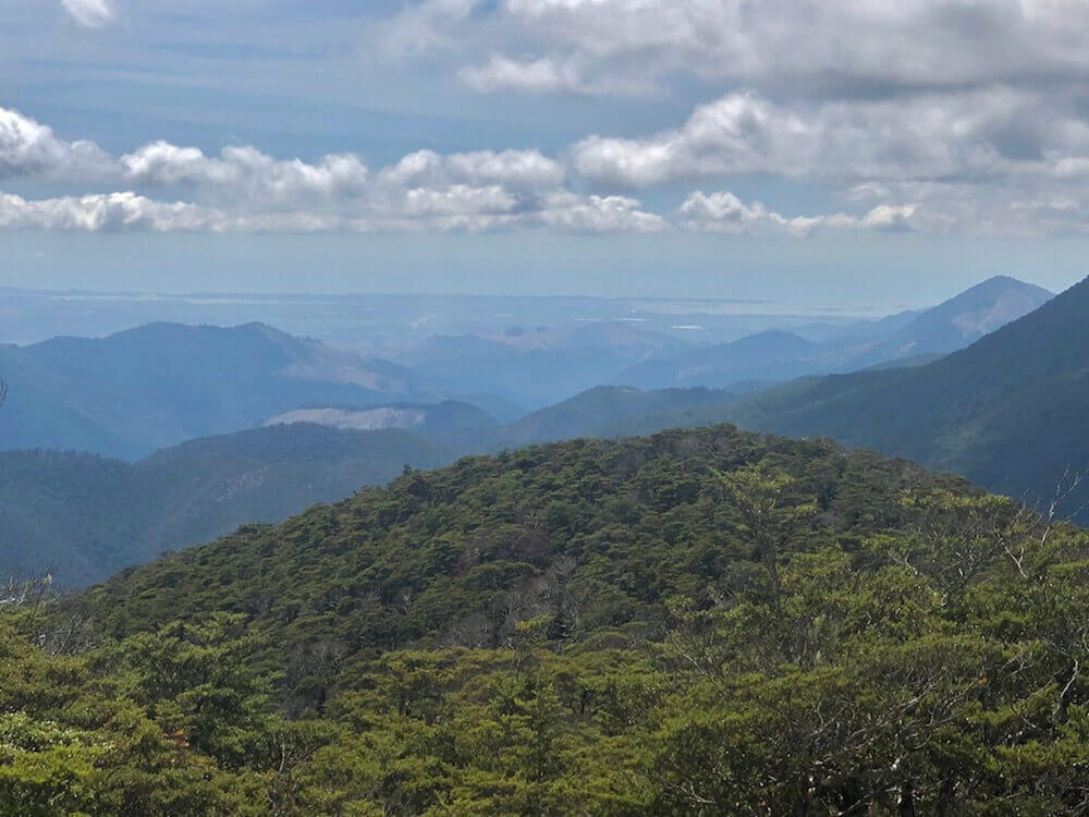
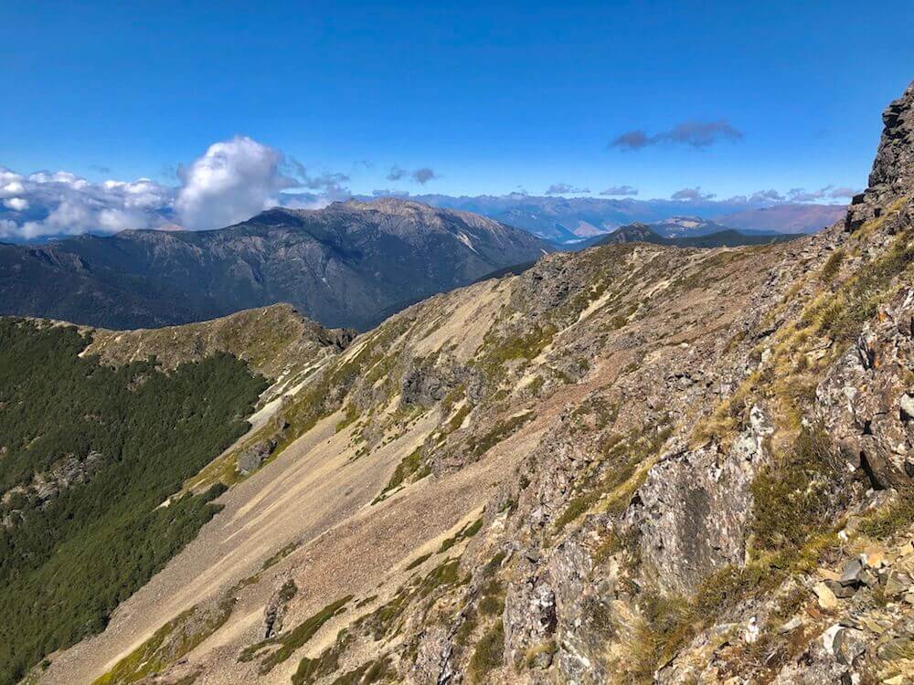
We had a steep 800m morning climb. I was excited because we were starting a section I was dying to see. It is a 30+km ridge which summits a few peaks including mount Rintoul (the Richmond Range second highest peak). We had a few good views today and we had a nice day, not too hot!
We had a steep 800m morning climb. I was excited because we were starting a section I was dying to see. It is a 30+km ridge which summits a few peaks including mount Rintoul (the Richmond Range second highest peak). We had a few good views today and we had a nice day, not too hot!
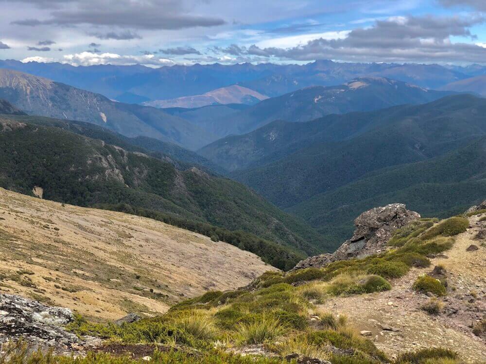
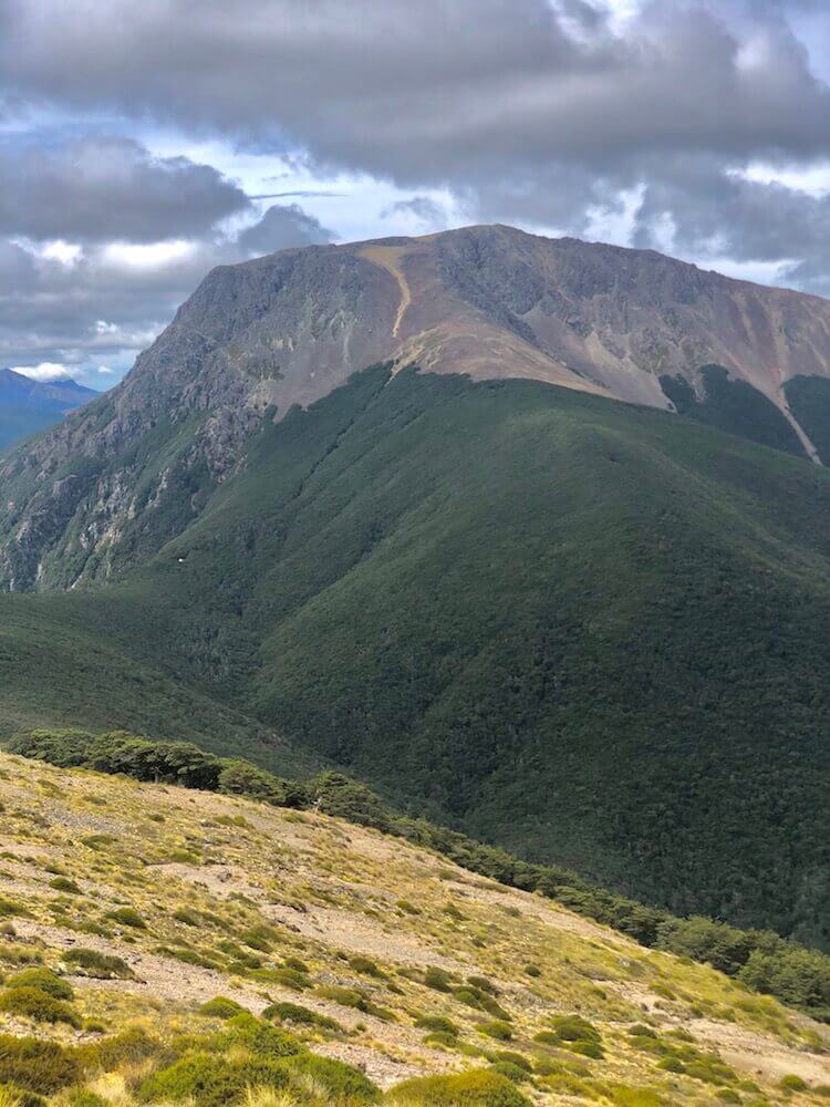
Day 52 ~ Distance: 18km, Climb: 1200m, Cumulative: 1260km
We started the day with a steep climb to the summit of mount Rintoul, the views were fantastic. This part is supposed to be the most challenging of the entire trail. It was a bit technical all the way to mount little Rintoul but I was expecting worst. It was a beautiful rocky ridge connecting the 2 peaks. The rest of the day we summited a few different peaks along the ridge, it was wonderful!
We started the day with a steep climb to the summit of mount Rintoul, the views were fantastic. This part is supposed to be the most challenging of the entire trail. It was a bit technical all the way to mount little Rintoul but I was expecting worst. It was a beautiful rocky ridge connecting the 2 peaks. The rest of the day we summited a few different peaks along the ridge, it was wonderful!


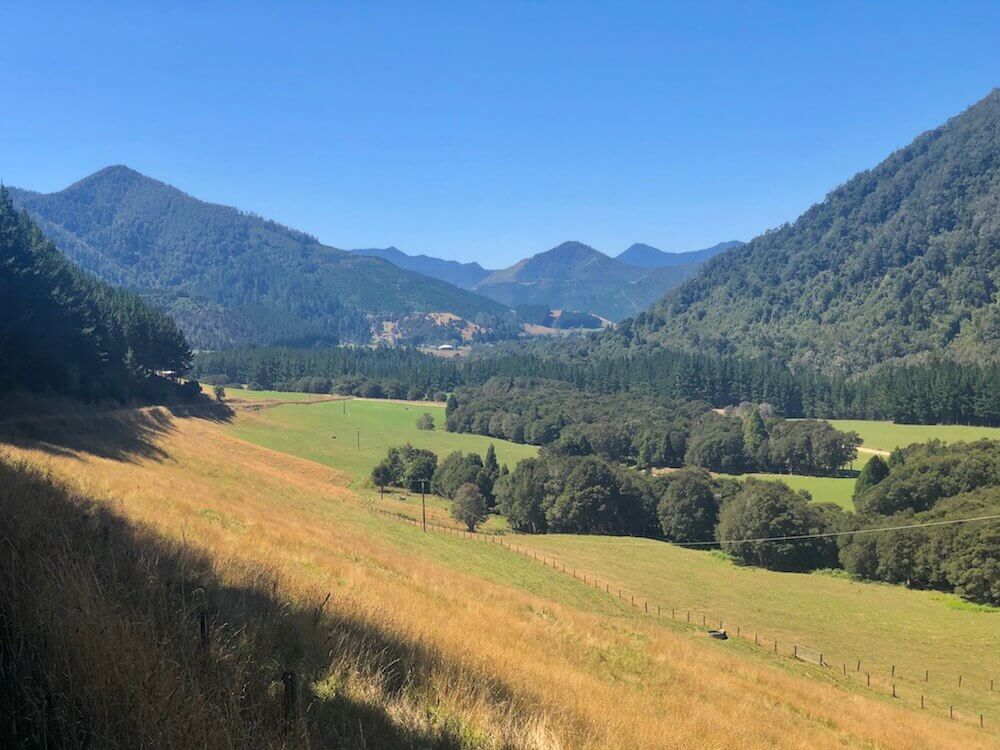
Day 53 ~ Distance: 23km, Climb: 650m, Cumulative: 1283km
We left my beloved ridge today and headed down into a valley to go back up to a saddle along another creek. From there it was about 13km descending into the valley to Middy Creek Hut, where it started getting more tropical and where we camped just outside of the hut.
We left my beloved ridge today and headed down into a valley to go back up to a saddle along another creek. From there it was about 13km descending into the valley to Middy Creek Hut, where it started getting more tropical and where we camped just outside of the hut.
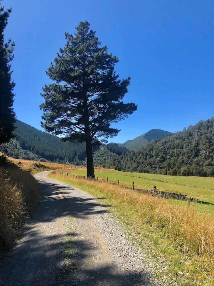
Day 54 ~ Distance: 40km, Climb: 550m, Cumulative: 1323km
We finished the Richmond Range; our last real challenge. The rest of the day was spent on roads, some paved, some gravel. It got more civilized as we advanced. Congrats for my hiking partner’s first ever 40km day! Tomorrow we will get into town, we will enjoy a nice shower after 8 days out.
We finished the Richmond Range; our last real challenge. The rest of the day was spent on roads, some paved, some gravel. It got more civilized as we advanced. Congrats for my hiking partner’s first ever 40km day! Tomorrow we will get into town, we will enjoy a nice shower after 8 days out.
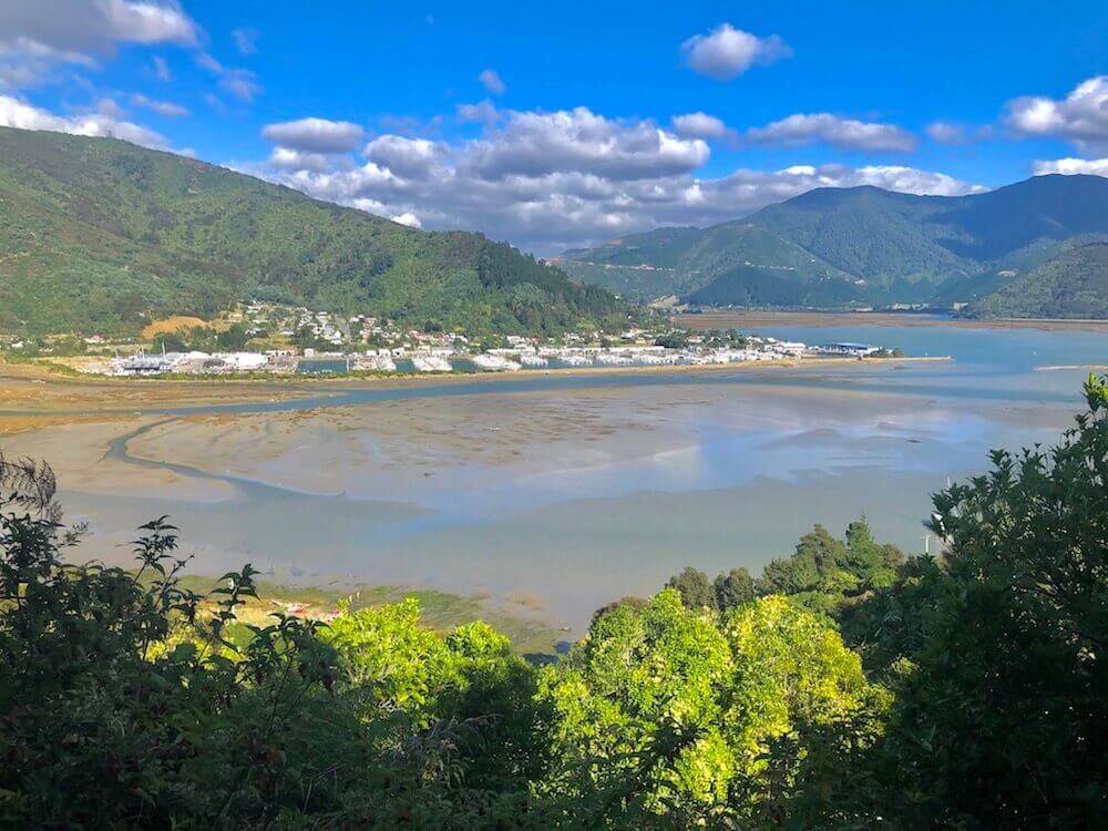
Day 55 ~ Distance: 10km, Climb: 30m, Cumulative: 1333km
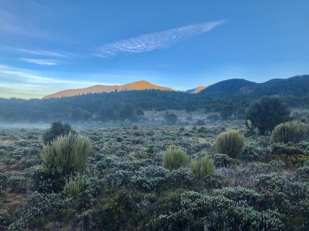
Our last 10km to Havelock started with a misty morning. Havelock is our last resupply before the end, which means my next post will be the last for this adventure. We got our permits for the upcoming section at the visitor centre, ate some good food and enjoyed breaking our longest none-shower streak of this trip.
Our last 10km to Havelock started with a misty morning. Havelock is our last resupply before the end, which means my next post will be the last for this adventure. We got our permits for the upcoming section at the visitor centre, ate some good food and enjoyed breaking our longest none-shower streak of this trip.
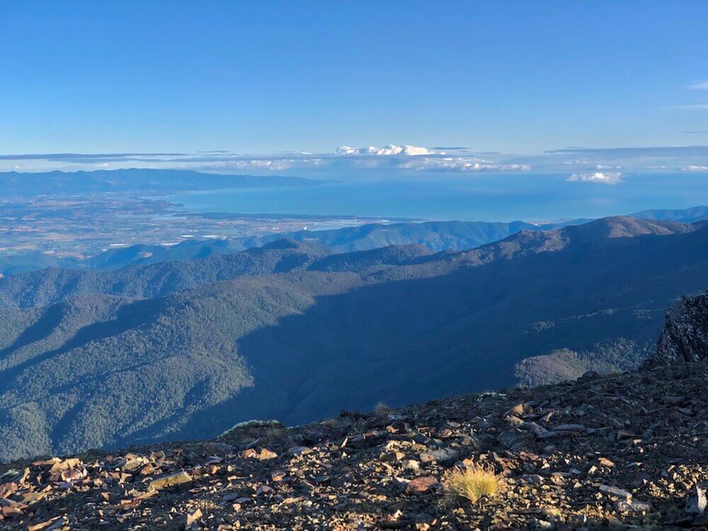
Day 56 ~ Distance: 40km, Climb: 800m, Cumulative: 1373km
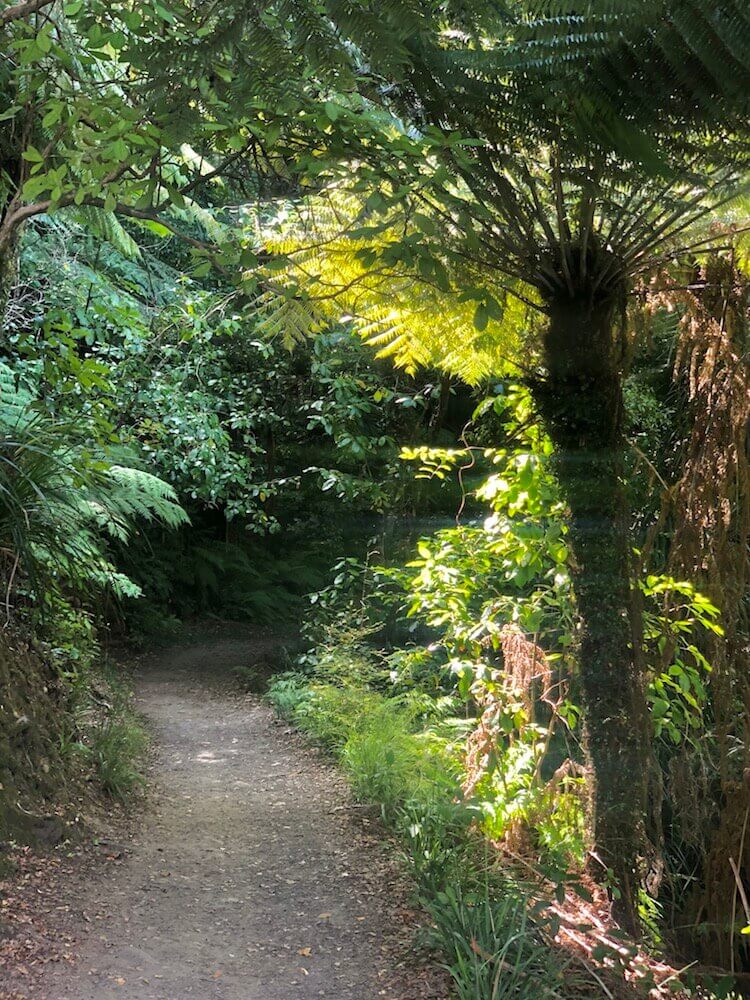
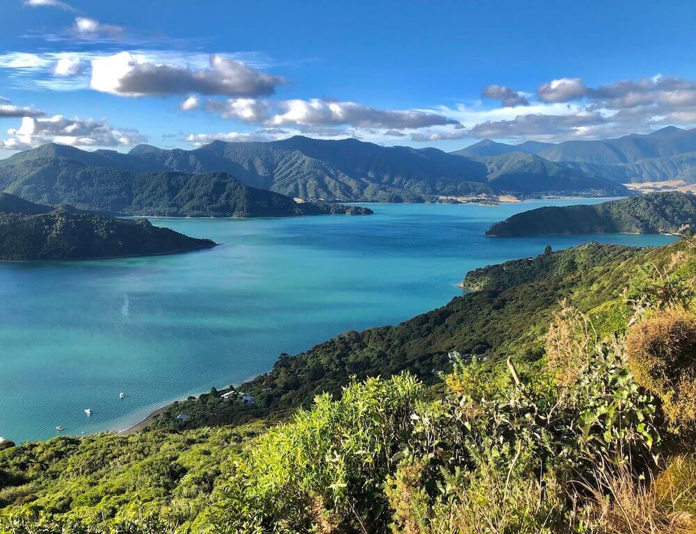
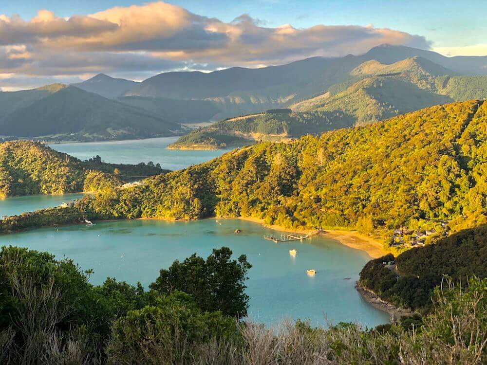
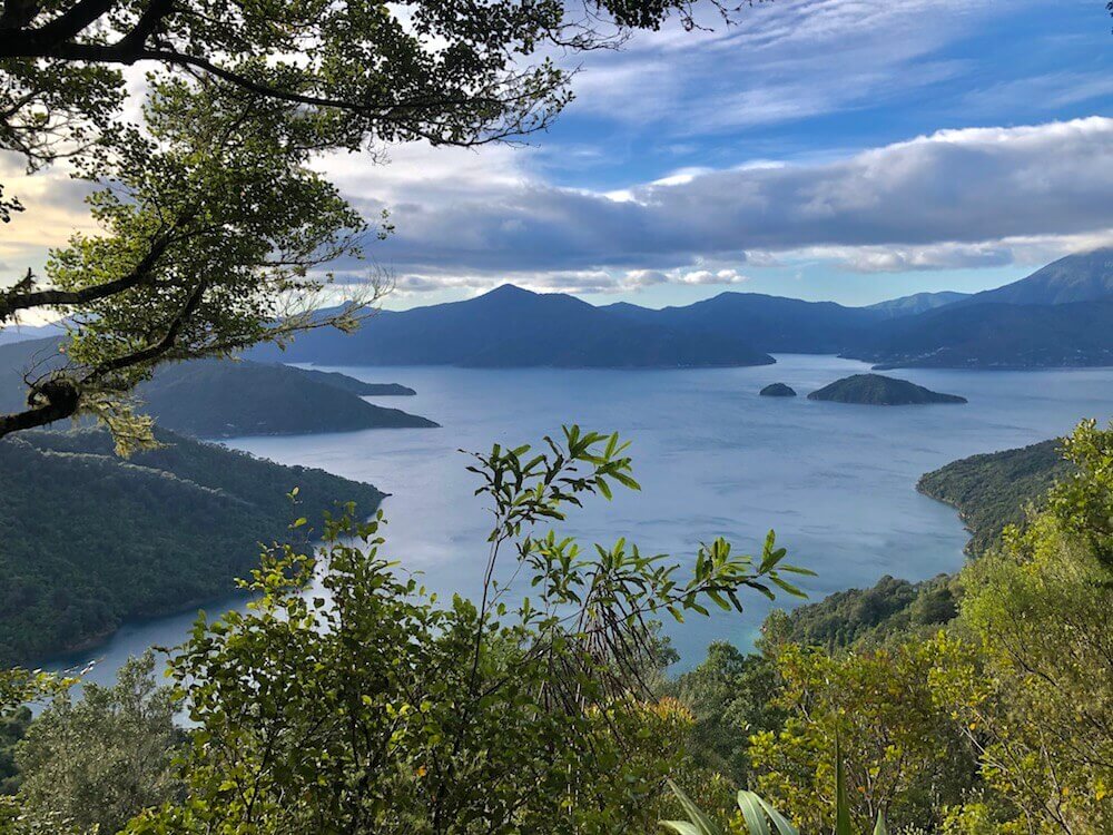
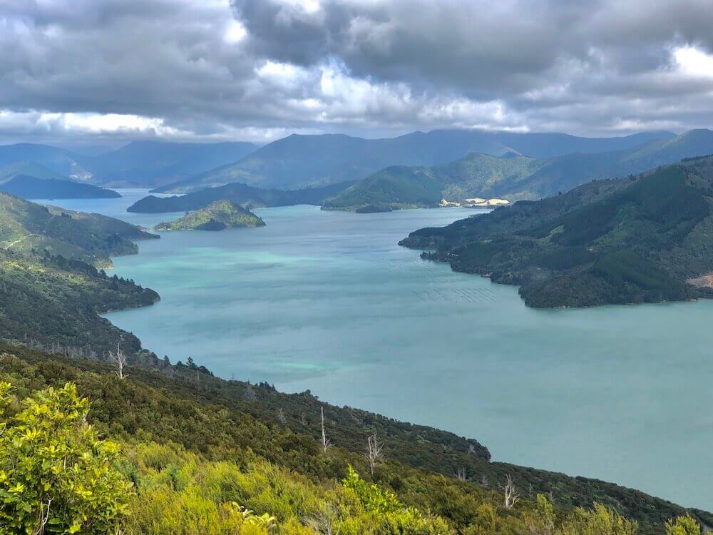
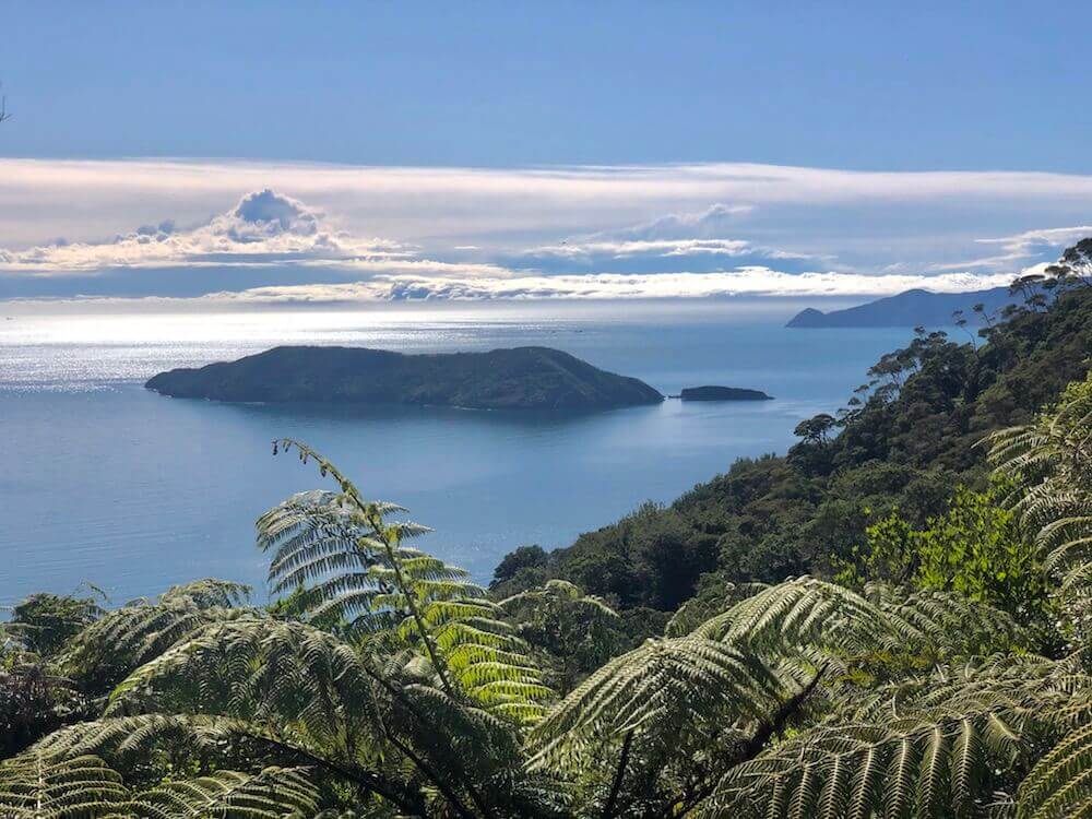
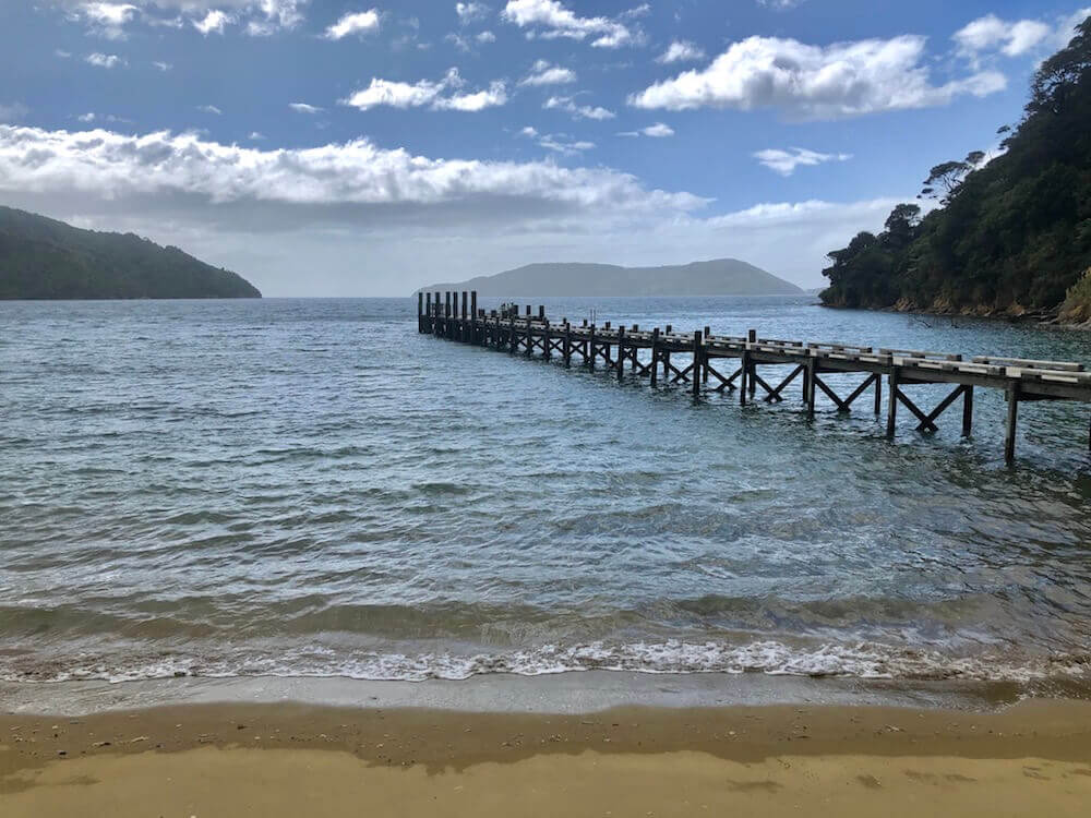
We walked about 20km before reaching the trailhead for Queen Charlotte Track. I was expecting these 20km to be mostly on the highway, to our surprise for most of the way we could avoid it. I was excited about that last part because Queen Charlotte Track is known for its gorgeous bay scenery, we weren’t disappointed. I will let the pictures explain...
We walked about 20km before reaching the trailhead for Queen Charlotte Track. I was expecting these 20km to be mostly on the highway, to our surprise for most of the way we could avoid it. I was excited about that last part because Queen Charlotte Track is known for its gorgeous bay scenery, we weren’t disappointed. I will let the pictures explain...


Day 57 ~ Distance: 45km, Climb: 950m, Cumulative: 1418km
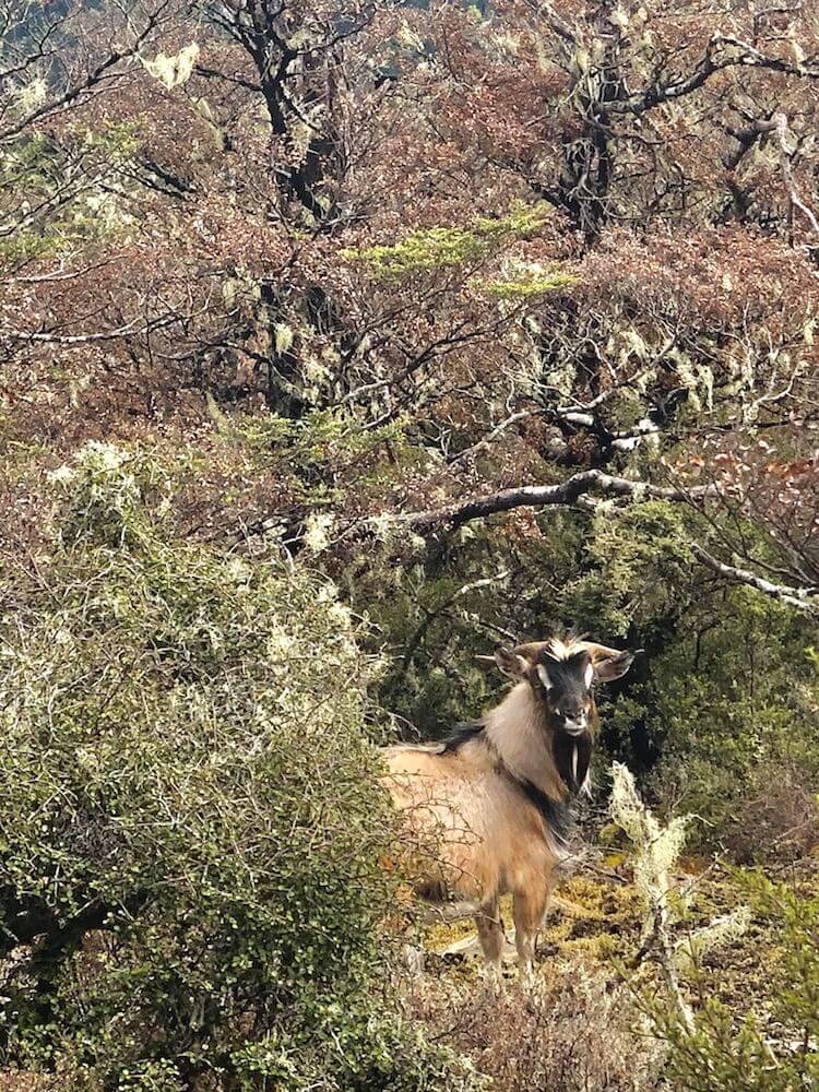
From the campground where we spent the night, we started with a climb and had beautiful views most of the morning. By the afternoon, the trail descended beside the shore and we followed the edge of the water for the rest of the day. We camped at a beach close to the forest (in case tide rises). Well, it was low tide 4-5h later we had to pack up and move since the water was within 1m of the tent and kept rising. We decided to walk the 8km to the campground even if it was the middle of the night. The stars were out, the thousands of crickets made their loud symphony with the ocean waves in the background. We turned off our headlamps multiple times to enjoy the night. To our surprise we were surrounded by lights, they were glowing worms! What a treat! As well we were blessed to sight over half a dozen possums (an animal we haven’t sighted before). We arrived around 3am at the campground and it was raining.
From the campground where we spent the night, we started with a climb and had beautiful views most of the morning. By the afternoon, the trail descended beside the shore and we followed the edge of the water for the rest of the day. We camped at a beach close to the forest (in case tide rises). Well, it was low tide 4-5h later we had to pack up and move since the water was within 1m of the tent and kept rising. We decided to walk the 8km to the campground even if it was the middle of the night. The stars were out, the thousands of crickets made their loud symphony with the ocean waves in the background. We turned off our headlamps multiple times to enjoy the night. To our surprise we were surrounded by lights, they were glowing worms! What a treat! As well we were blessed to sight over half a dozen possums (an animal we haven’t sighted before). We arrived around 3am at the campground and it was raining.
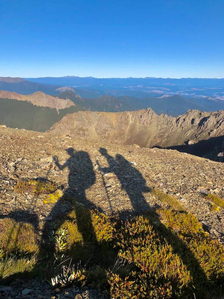
Day 58 ~ Distance: 7km, Climb: 250m, Cumulative: 1425km
We slept in and started late since we only had about 7km to the end! 7km only! The weather was gorgeous. We started walking and shared some of the hardest days we had. 5km; we laugh about some of the funniest moments. 3km; we reminded each other of some of the best views this long walk had to offer. 2km; we talked about our favourite campsites 1km; our last few steps...
*Special thanks to every land owner that allowed hikers to pass through their land, to every volunteer and staff that worked hard into creating and maintaining this trail, to my hiking partner for sticking to our plan and being flexible when needed, to mother nature for being so wonderful, and to you for taking the time to read.


|
If you want to help me out.
Support this website |
Any questions or comments?
Contact me |
Treks Travels Thoughts is uncopyrighted