“Writing in a journal each day allows you to direct your focus to what you accomplished, what you’re grateful for and what you’re committed to doing better tomorrow.” -Hal Elrod
Day 15 ~ Distance: 32km, Climb: 20m, Cumulative: 395km
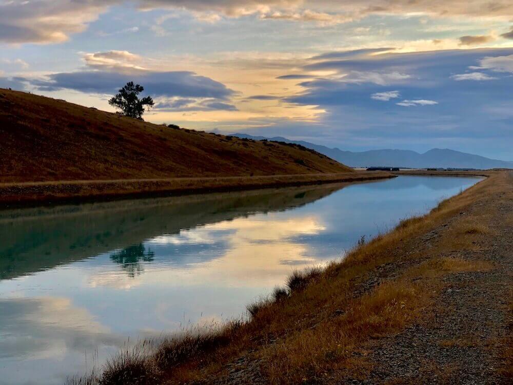
After setting down our camp that was only a few kilometres from the car park. Which marked the end of the Routeburn track a World Heritage Site, the rest of the day was on roads to the city of Glenorchy. A nice shower, some fresh food, and one of our resupplying* points are waiting for us.
*Big thx to the owner/operator of the general store beside Glenorchy Hotel for giving us free food that had just past the expiration date.
Day 16 ~ Distance: 38km, Climb: 600m, Cumulative: 433km
The two general stores in Glenorchy were very minimal with a steep price tag. We managed to find a few things. It will be fewer calories than we have been going on since the start but it is only 120km to the next bigger resupply town. Another of my detour. The first 20km was mostly on a none-busy road. Then it was 18km to make it to Shelter Rock Hut. Yes, a first night using our hut pass. We just started using it because we are both not a big fan of dormitories but we still want to get a few uses out of our card.
The two general stores in Glenorchy were very minimal with a steep price tag. We managed to find a few things. It will be fewer calories than we have been going on since the start but it is only 120km to the next bigger resupply town. Another of my detour. The first 20km was mostly on a none-busy road. Then it was 18km to make it to Shelter Rock Hut. Yes, a first night using our hut pass. We just started using it because we are both not a big fan of dormitories but we still want to get a few uses out of our card.
Day 17 ~ Distance: 23km, Climb: 1500m, Cumulative: 456km
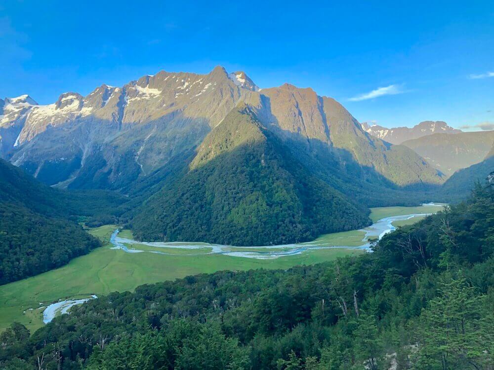
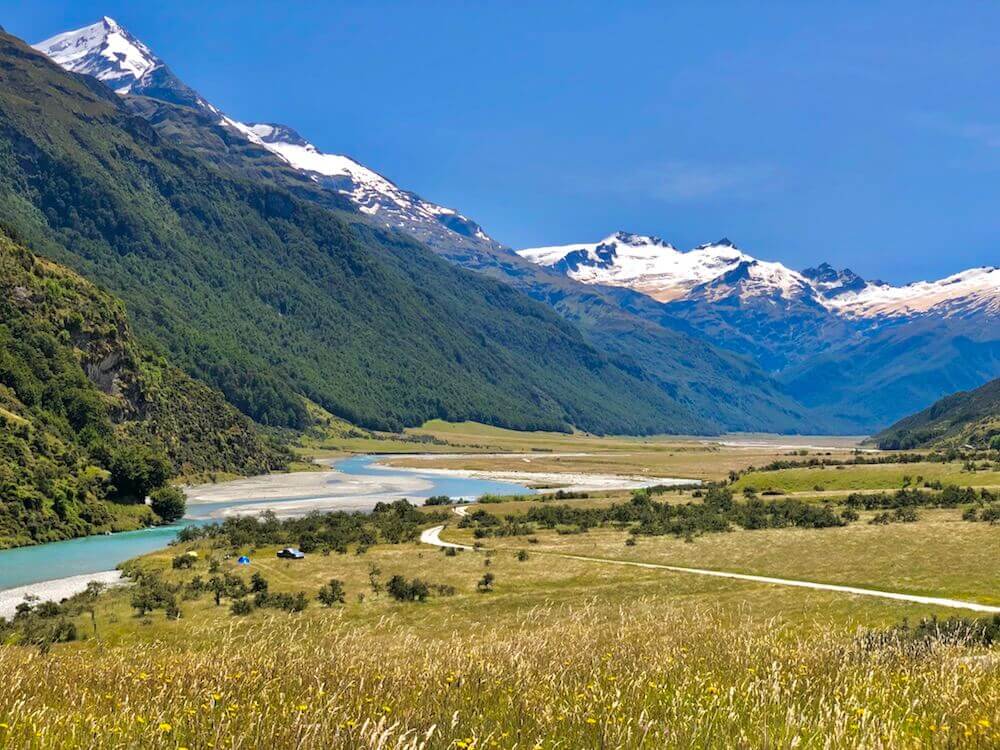
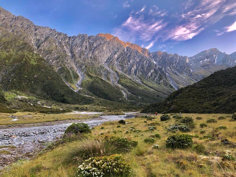
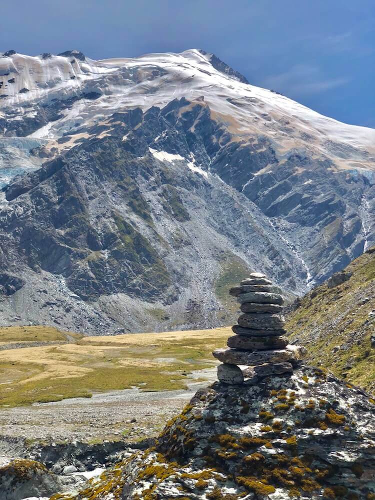
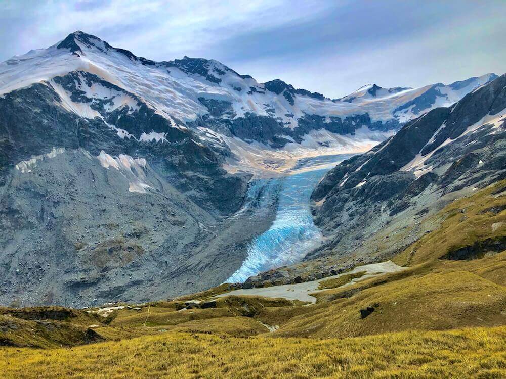
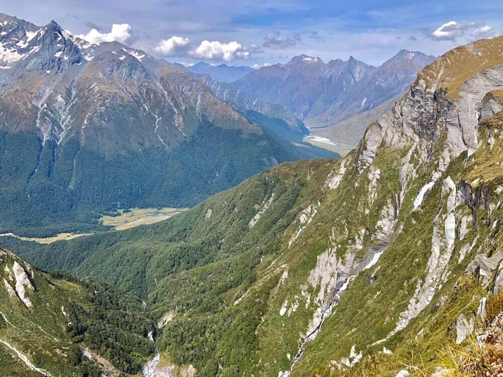
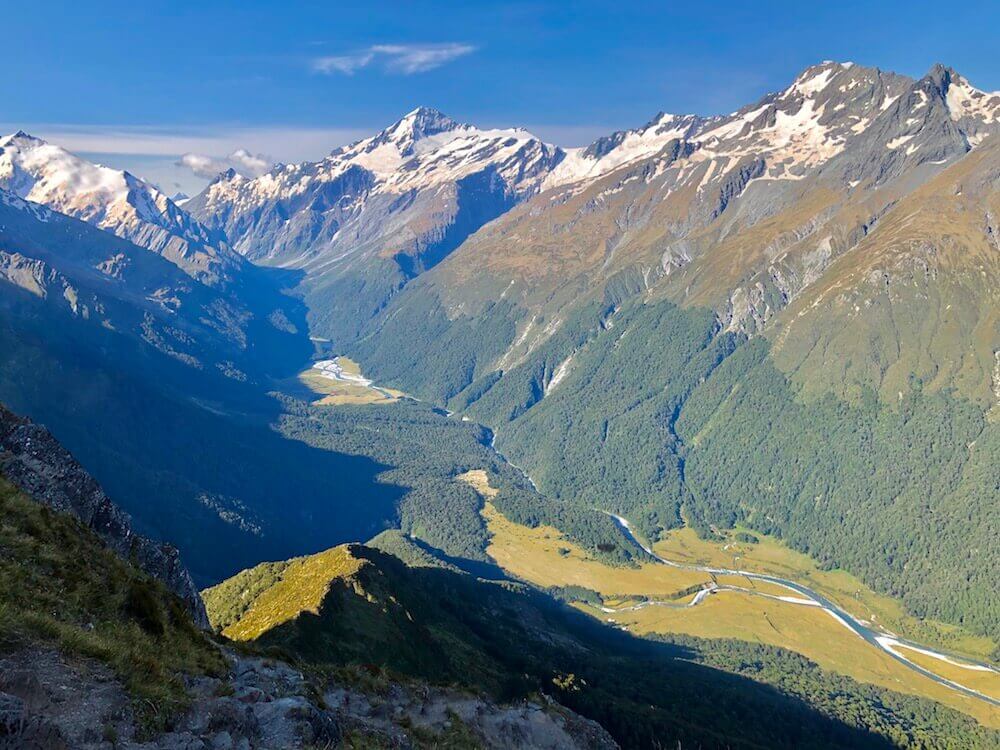
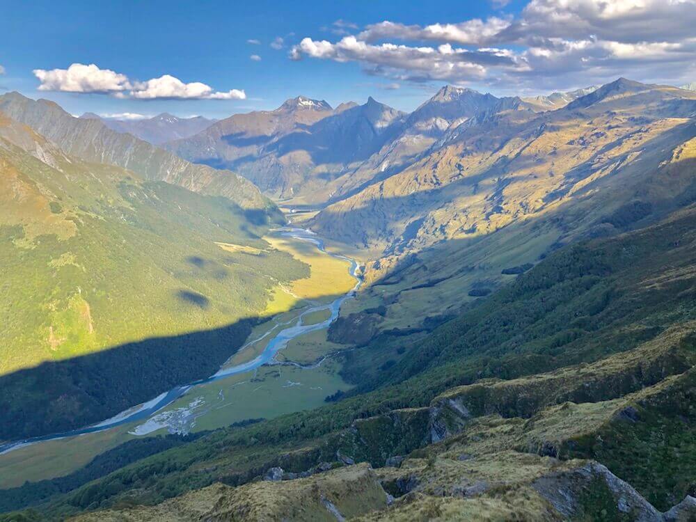
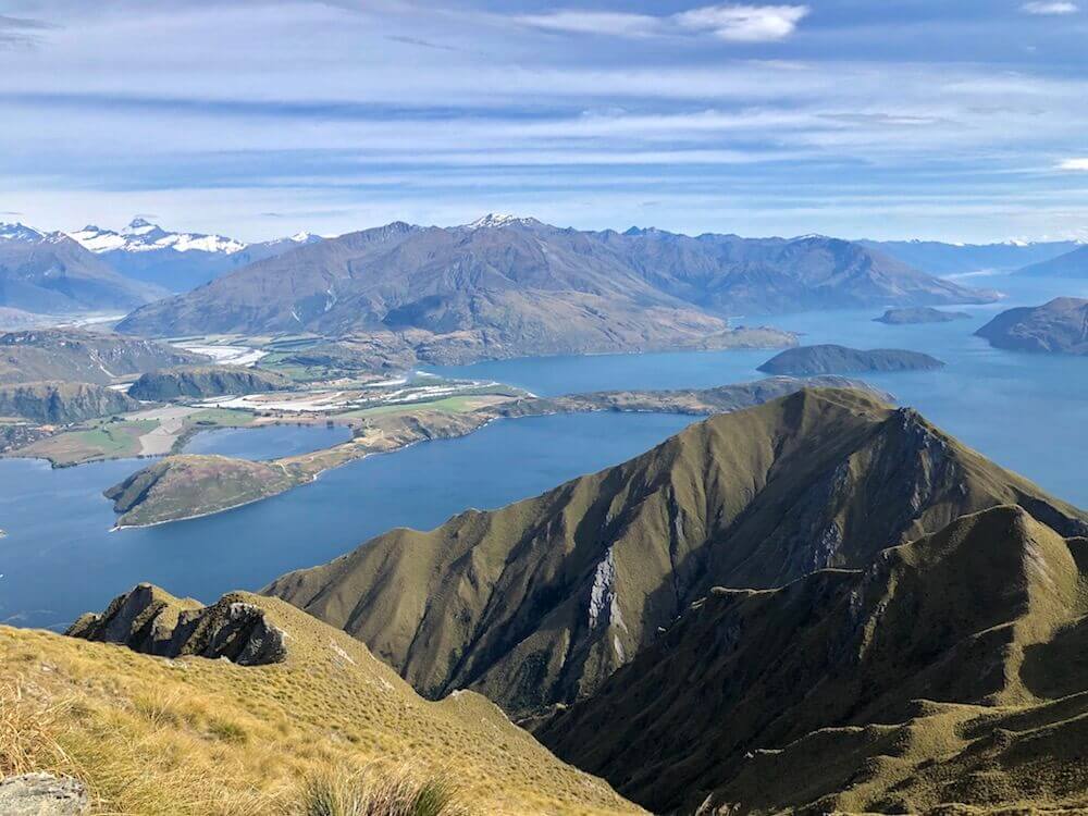
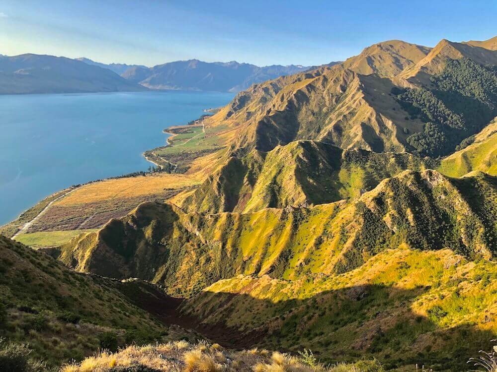
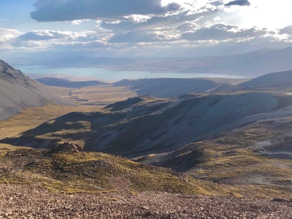
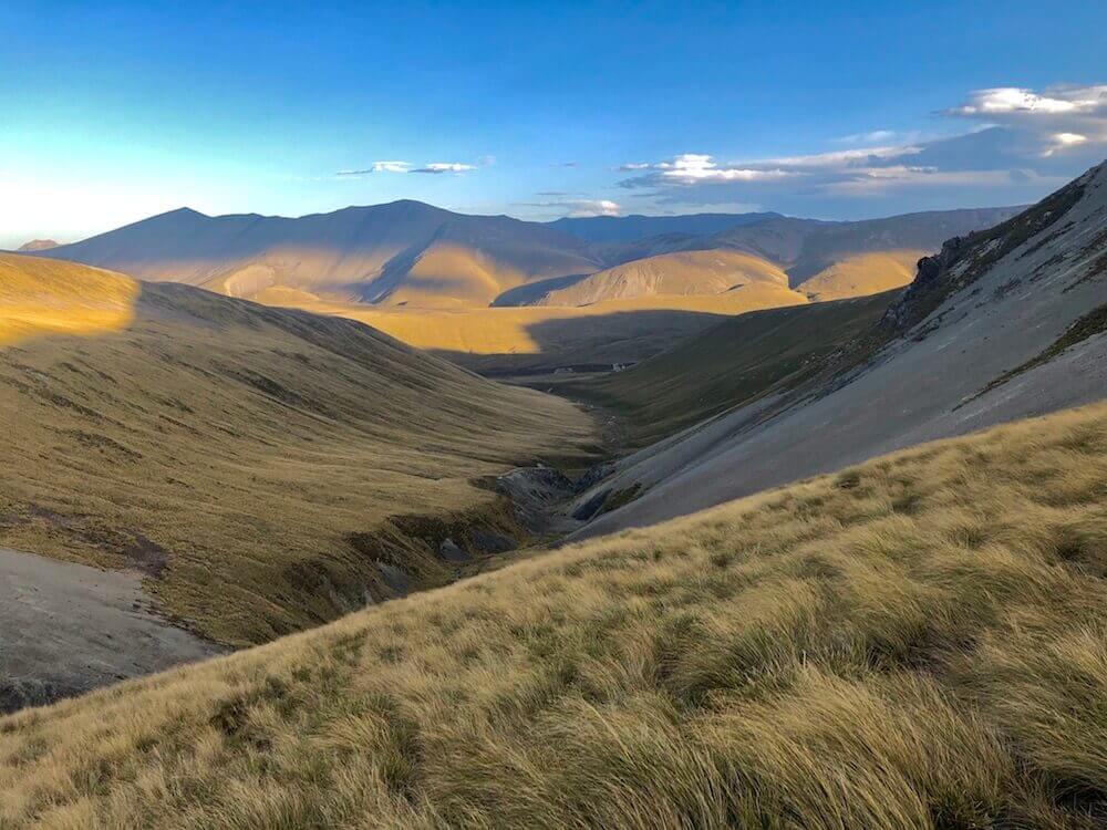
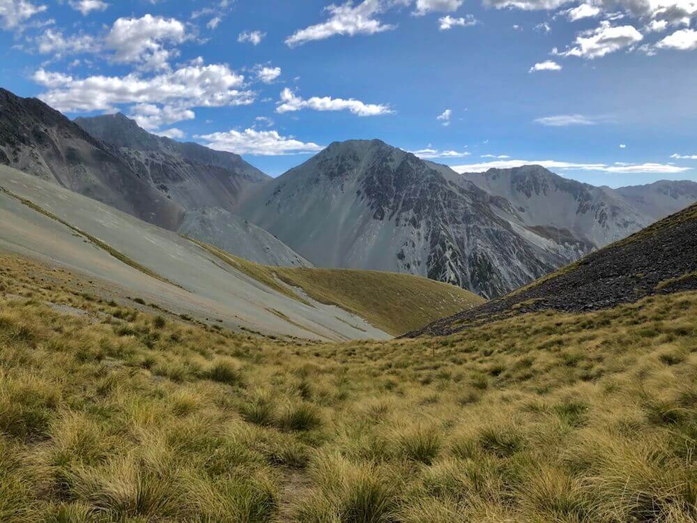
Our best day scenery-wise, so far anyway! I got to say, my detours are awesome! We started making our way up a valley to a saddle where on the other side was a tighter valley with a gorge-like river. At the end of it, we went upstream along another river, one that will later become a glacier. We climbed beside that glacier and an even more beautiful view over the next valley awaited us on the other side. Truly magnificent! Straight out of an outdoor magazine. From the last saddle (~1800m) we started making our way down into the next valley. The trail was a little exposed especially the first part, I was glad it wasn’t icy. Later, I learned that this decent (Cascade Saddle) was ranked among the most dangerous trails in the world. When we reached the tree line, we found a perfect flat campsite beside the steep trail. It was too good to pass on it.
Our best day scenery-wise, so far anyway! I got to say, my detours are awesome! We started making our way up a valley to a saddle where on the other side was a tighter valley with a gorge-like river. At the end of it, we went upstream along another river, one that will later become a glacier. We climbed beside that glacier and an even more beautiful view over the next valley awaited us on the other side. Truly magnificent! Straight out of an outdoor magazine. From the last saddle (~1800m) we started making our way down into the next valley. The trail was a little exposed especially the first part, I was glad it wasn’t icy. Later, I learned that this decent (Cascade Saddle) was ranked among the most dangerous trails in the world. When we reached the tree line, we found a perfect flat campsite beside the steep trail. It was too good to pass on it.

Day 18 ~ Distance: 30km, Climb: 70m, Cumulative: 486km
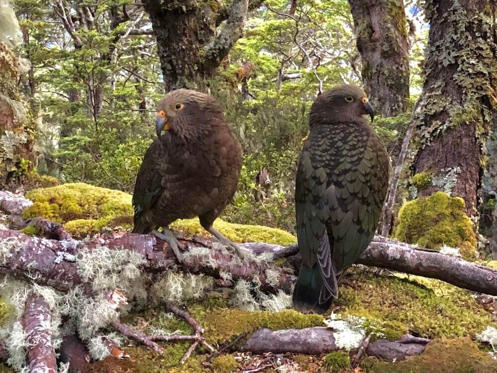
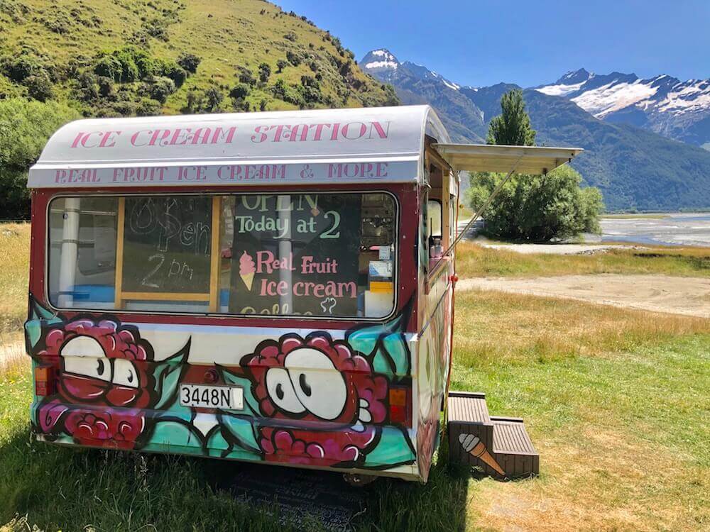
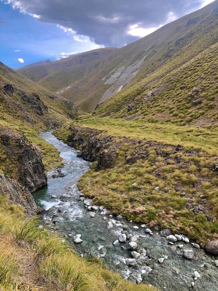
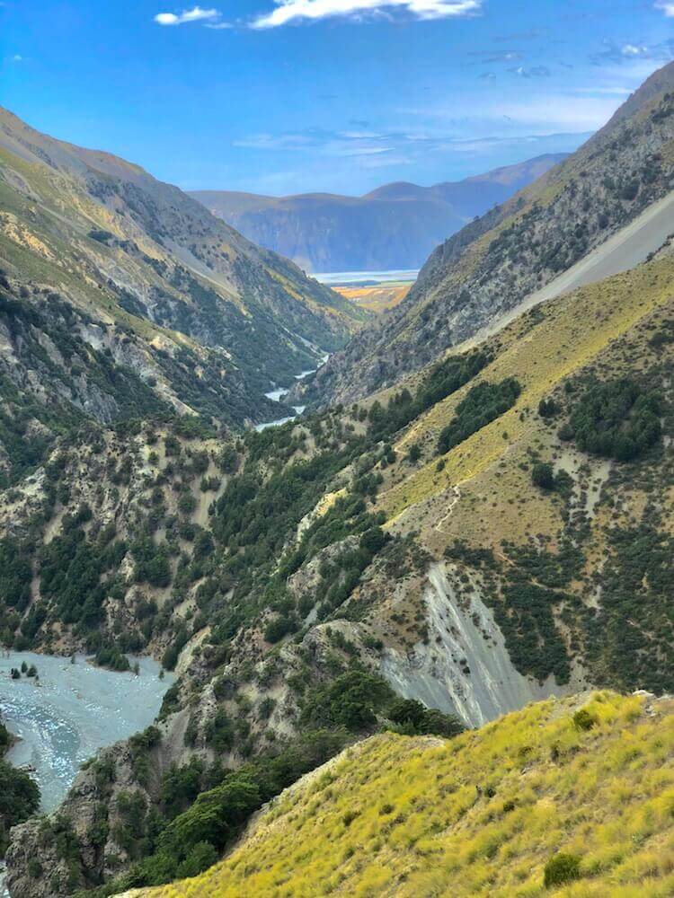
I didn’t sleep so well, we had a few Keas (Mountain Parrot) making their loud call all night long, and they were only a few metres from the tent. We finished our descent into the valley and followed the river for about 10km. The rest of the day was on a gravel road on the way to Wanaka. It was hot today, felt above 30. We cooled off in the river a few times. We got really lucky when beside a gravel road, still over 40km away from the nearest city we ran into a small food truck selling real fruit ice cream! At first, it felt like a mirage... But that too good to be true ended up being real! That treat made our day twice! (Because we ate two each!)
I didn’t sleep so well, we had a few Keas (Mountain Parrot) making their loud call all night long, and they were only a few metres from the tent. We finished our descent into the valley and followed the river for about 10km. The rest of the day was on a gravel road on the way to Wanaka. It was hot today, felt above 30. We cooled off in the river a few times. We got really lucky when beside a gravel road, still over 40km away from the nearest city we ran into a small food truck selling real fruit ice cream! At first, it felt like a mirage... But that too good to be true ended up being real! That treat made our day twice! (Because we ate two each!)
Day 19 ~ Distance: 34km, Climb: 120m, Cumulative: 520km
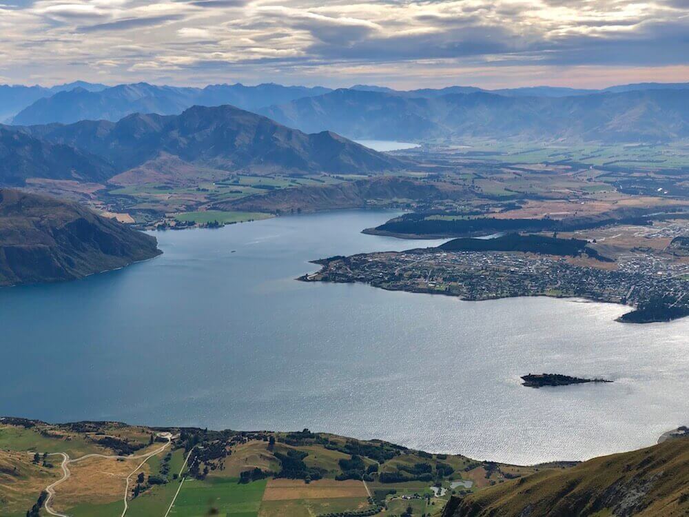
My hiking partner decided to hitchhike into town (Wanaka) since it wasn’t part of the official trail (but of my detour). Ironically the car that stopped was the same family that served us the ice cream the day before. I decided to walk the 34km into town. I arrived in the early afternoon. The rest of the day was a classic town day; a well-deserved shower, a more than due laundry load, a bit of wifi (mostly spent on this blog post, hope you will enjoy), buying food in the groceries as if I had a family of twelve to feed for a week, and eating fresh food like starving beasts. You know the classics...
My hiking partner decided to hitchhike into town (Wanaka) since it wasn’t part of the official trail (but of my detour). Ironically the car that stopped was the same family that served us the ice cream the day before. I decided to walk the 34km into town. I arrived in the early afternoon. The rest of the day was a classic town day; a well-deserved shower, a more than due laundry load, a bit of wifi (mostly spent on this blog post, hope you will enjoy), buying food in the groceries as if I had a family of twelve to feed for a week, and eating fresh food like starving beasts. You know the classics...

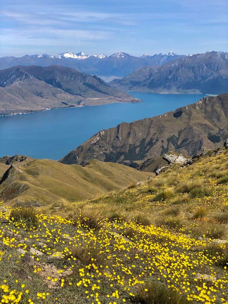
Day 20 ~ Distance: 0km, Climb: 0m, Cumulative: 520km
We decided to take a full rest day. The last one we had was about 2 weeks ago in Otautau. So theoretically rest days are meant for rest, but my love for the mountains pushed me to do a 26km day hike*. I went alone climbing Roy’s Peak, the view was fabulous! I came back around midday, the rest of the day was spent doing you know... the classics stated above.
*Thx to the lovely couple from the USA that gave me a ride to the trailhead.
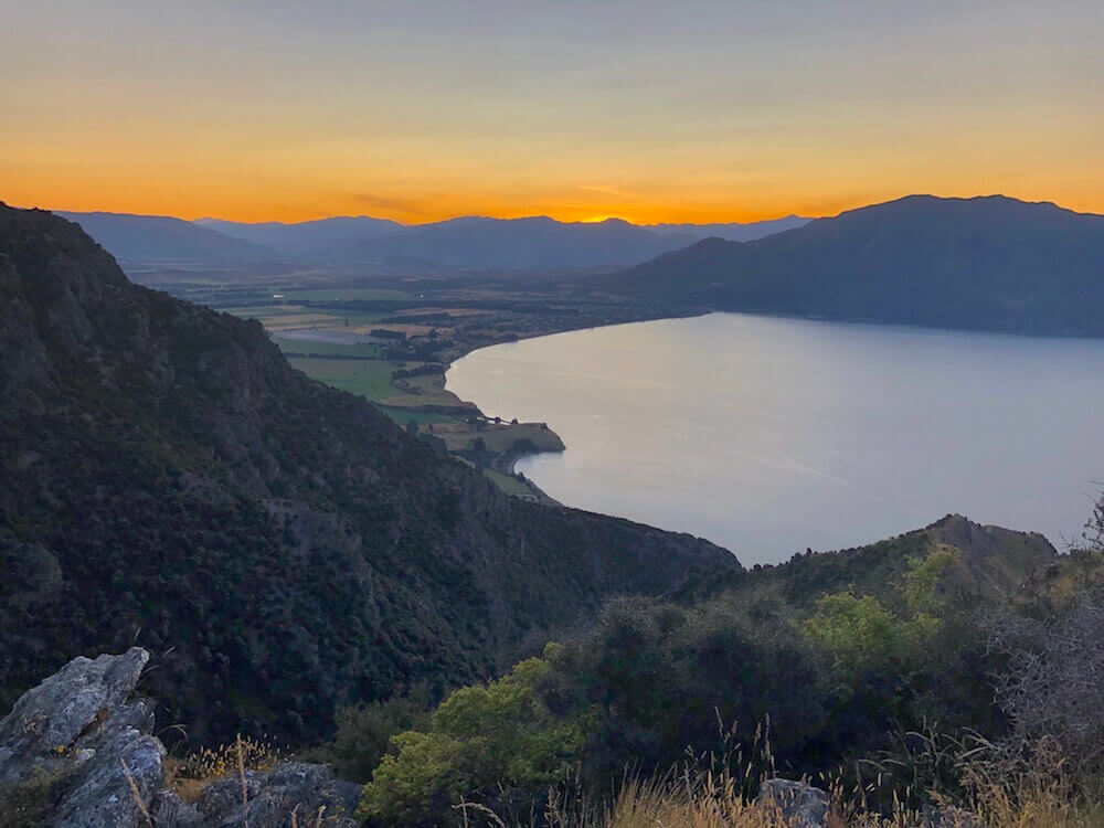
Day 21 ~ Distance: 35km, Climb: 550m, Cumulative: 555km
We left Wanaka and followed the trail along Wanaka Lake, the lake drains by Clutha River, which we followed for a while. We left Clutha River for Hawea River which we walked upstream to Hawea Lake. We reached a town there and it was boiling hot. So we treated ourselves with cold drinks and frozen fruits. Then pushed on to a mountain range which we climbed halfway before setting camp.
We left Wanaka and followed the trail along Wanaka Lake, the lake drains by Clutha River, which we followed for a while. We left Clutha River for Hawea River which we walked upstream to Hawea Lake. We reached a town there and it was boiling hot. So we treated ourselves with cold drinks and frozen fruits. Then pushed on to a mountain range which we climbed halfway before setting camp.
Day 22 ~ Distance: 20km, Climb: 1250m, Cumulative: 575km
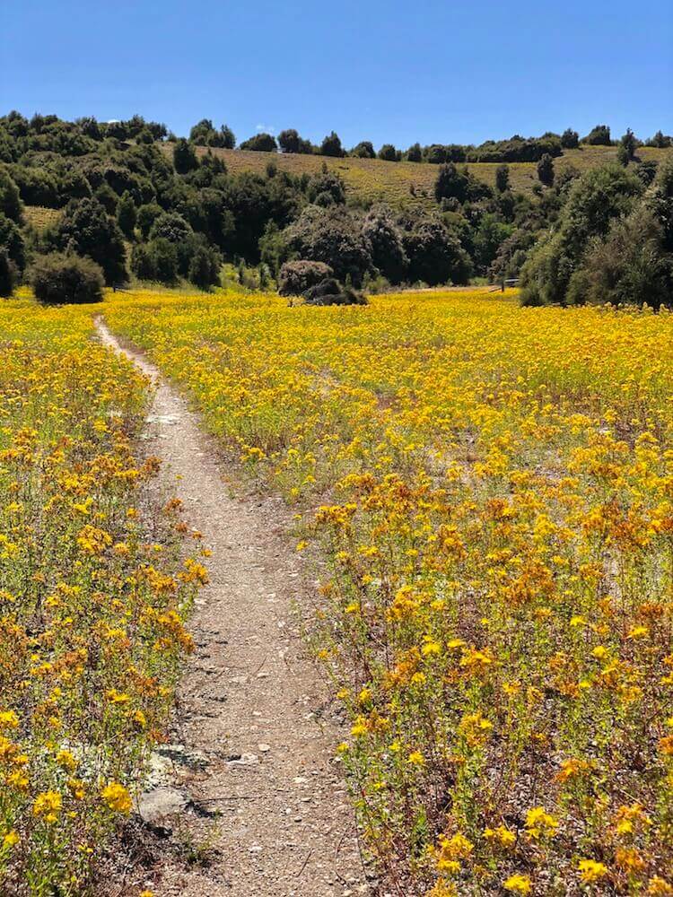
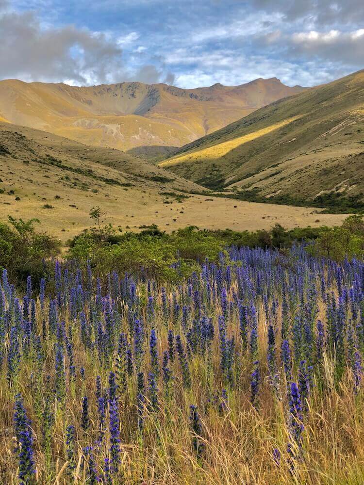
We managed to do most of the climb before it got too hot and trust me it got hot! The ridge was very nice with the flowers and, of course, the views. We descended into a valley and followed the Timaru River for the rest of the day. Our camp was the most buggy we had so far... blackflies... lots of them!
We managed to do most of the climb before it got too hot and trust me it got hot! The ridge was very nice with the flowers and, of course, the views. We descended into a valley and followed the Timaru River for the rest of the day. Our camp was the most buggy we had so far... blackflies... lots of them!

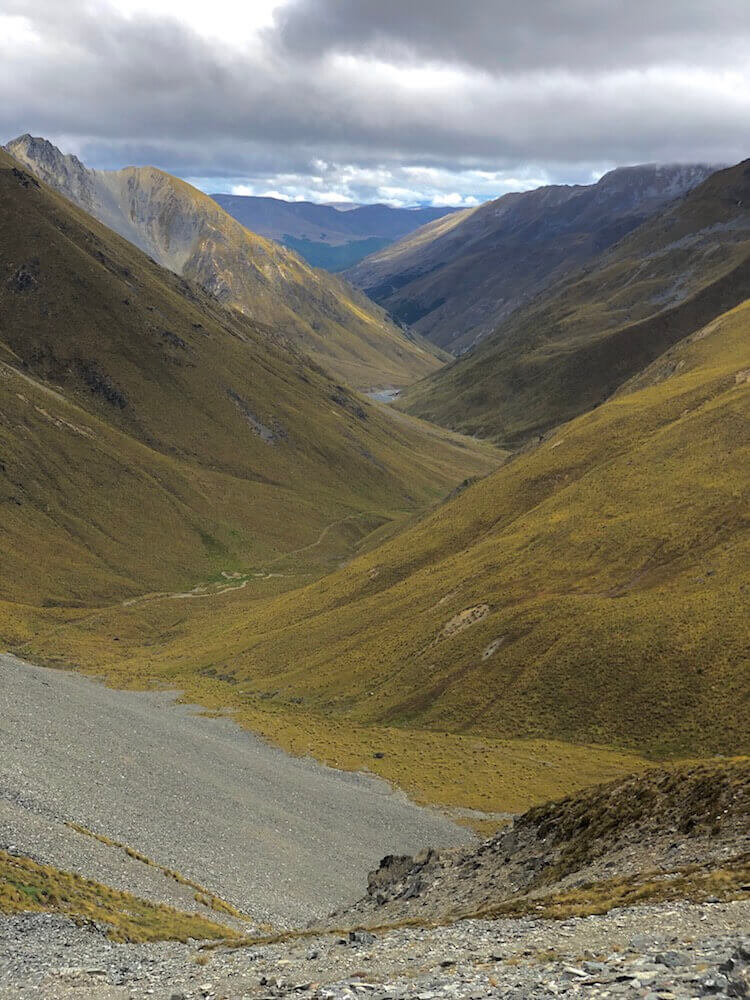
Day 23 ~ Distance: 36km, Climb: 1200m, Cumulative: 611km
We made it out of that buggy valley and arrived at Top Timaru Hut where we took a break and enjoyed some food while it was raining. We then kept climbing all the way to Martha Saddle (~1800m), the next valley was just as beautiful. By then, the rain subsided and gave place to the sun. We had to cross our biggest river so far (Ahuriri River), it was slightly above the waist, but the current wasn’t too strong so it went well. In this valley the trees are scarce, but we managed to find a pretty cozy and sheltered spot.
We made it out of that buggy valley and arrived at Top Timaru Hut where we took a break and enjoyed some food while it was raining. We then kept climbing all the way to Martha Saddle (~1800m), the next valley was just as beautiful. By then, the rain subsided and gave place to the sun. We had to cross our biggest river so far (Ahuriri River), it was slightly above the waist, but the current wasn’t too strong so it went well. In this valley the trees are scarce, but we managed to find a pretty cozy and sheltered spot.

Day 24 ~ Distance: 32km, Climb: 660m, Cumulative: 643km
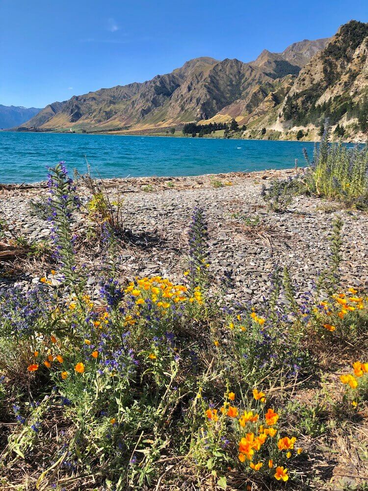
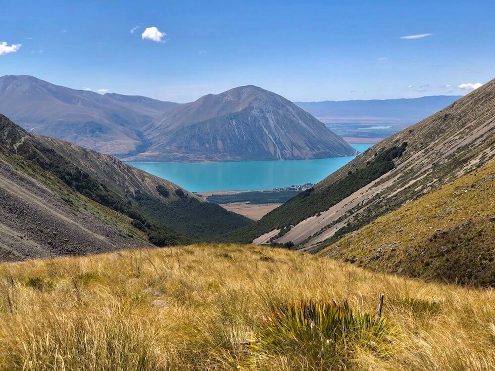
We went over another saddle (I know so many saddles already) and descended towards Lake Ohau. The views were fantastic and we were quite happy to get some trees again since the sun was once more pretty hot. We made it to the lake, the rest of the afternoon was spent walking along its shores. The wind picked up but we managed to find a nice sheltered spot. We will fall asleep hearing the wave of the lake against its shores. (The wind is strong enough that it sounds like the sea.)
We went over another saddle (I know so many saddles already) and descended towards Lake Ohau. The views were fantastic and we were quite happy to get some trees again since the sun was once more pretty hot. We made it to the lake, the rest of the afternoon was spent walking along its shores. The wind picked up but we managed to find a nice sheltered spot. We will fall asleep hearing the wave of the lake against its shores. (The wind is strong enough that it sounds like the sea.)
Day 25 ~ Distance: 22km, Climb: 20m, Cumulative: 665km
We had a good night of sleep. We were all packed ready to move by 7am. We walked along the lake a little more and then along Ohau River. We made it into Twizel by midday, stopped at a grocery store for a cold juice and a quick bite. We then proceeded to the campground where we did all our town chores. Spent the rest of the day chilling and eating.
We had a good night of sleep. We were all packed ready to move by 7am. We walked along the lake a little more and then along Ohau River. We made it into Twizel by midday, stopped at a grocery store for a cold juice and a quick bite. We then proceeded to the campground where we did all our town chores. Spent the rest of the day chilling and eating.
Day 26 ~ Distance: 35km, Climb: 230m, Cumulative: 700km
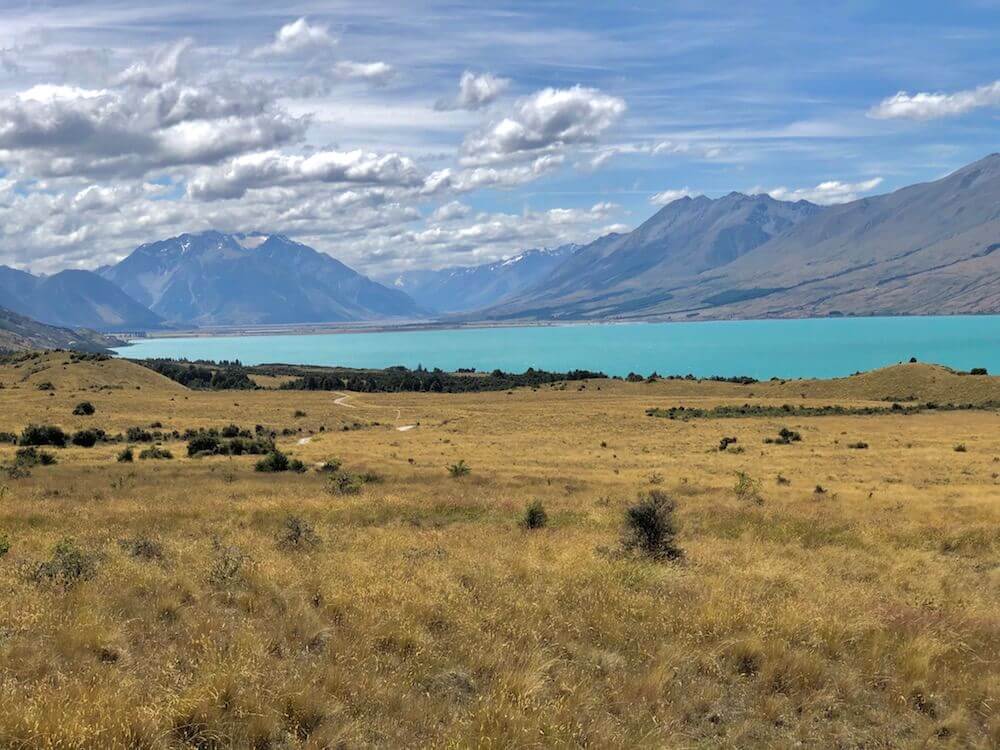
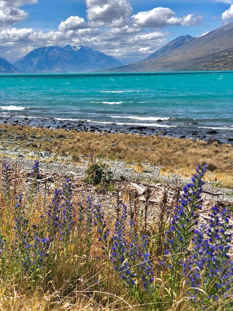
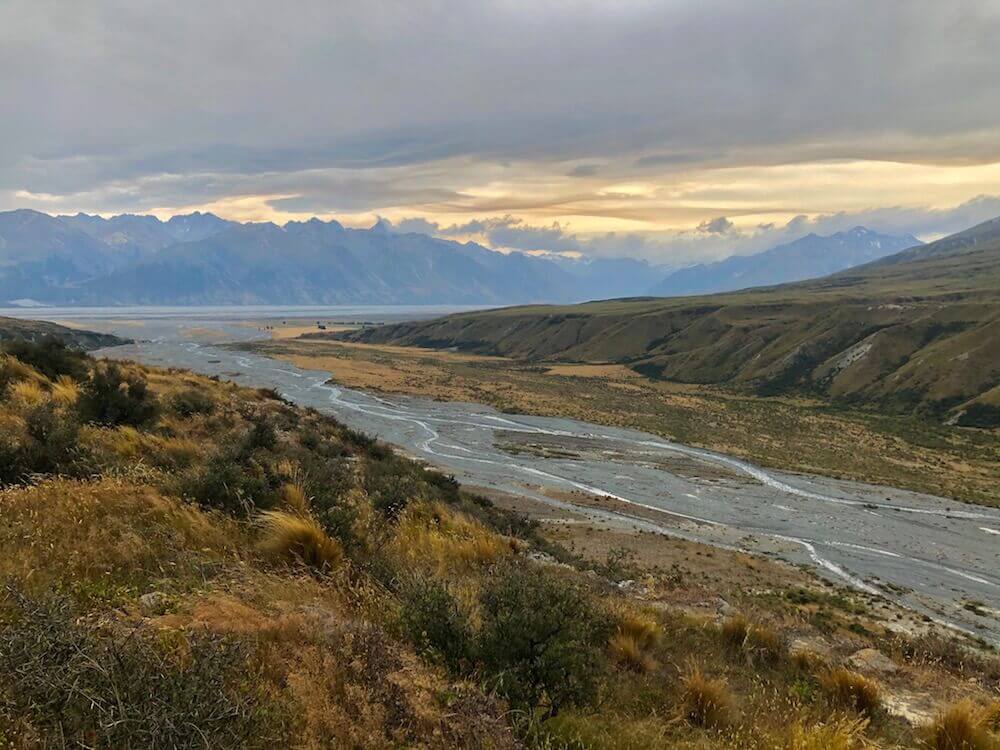
We left Twizel hiked on a bicycle trail most of the day. Before we reached Lake Pukaki we could see in the far back Mount Cook (New Zealand highest peak, 3724m). It was impressive even 60+ km away. We walked on the edge of the lake and left it for Tekapo Canal which we followed for the rest of the day. It was once more hard to find a good sheltered spot for the night, but we got lucky.
We left Twizel hiked on a bicycle trail most of the day. Before we reached Lake Pukaki we could see in the far back Mount Cook (New Zealand highest peak, 3724m). It was impressive even 60+ km away. We walked on the edge of the lake and left it for Tekapo Canal which we followed for the rest of the day. It was once more hard to find a good sheltered spot for the night, but we got lucky.

Day 27 ~ Distance: 31km, Climb: 120m, Cumulative: 731km
We followed the rest of the Tekapo Canal to the lake and village (of the same name). We stopped in the town to resupply for 6 days of food. We had lunch with some newly bought fresh food. We then walked along the shore of the lake until we found two huge trees surrounded by bushes that made a perfect campsite in this windy section.
We followed the rest of the Tekapo Canal to the lake and village (of the same name). We stopped in the town to resupply for 6 days of food. We had lunch with some newly bought fresh food. We then walked along the shore of the lake until we found two huge trees surrounded by bushes that made a perfect campsite in this windy section.
Day 28 ~ Distance: 39km, Climb: 1400m, Cumulative: 770km
We climbed very slowly over most of the day. In the late afternoon we made it to the Te Araroa highest point, Stag Saddle (1925m). We pushed into the other valley and made it to the next hut, but already 4 people were in there sleeping and we arrived quite late so we decided to make camp 100m away.
We climbed very slowly over most of the day. In the late afternoon we made it to the Te Araroa highest point, Stag Saddle (1925m). We pushed into the other valley and made it to the next hut, but already 4 people were in there sleeping and we arrived quite late so we decided to make camp 100m away.

Day 29 ~ Distance: 25km, Climb: 700m, Cumulative: 795km
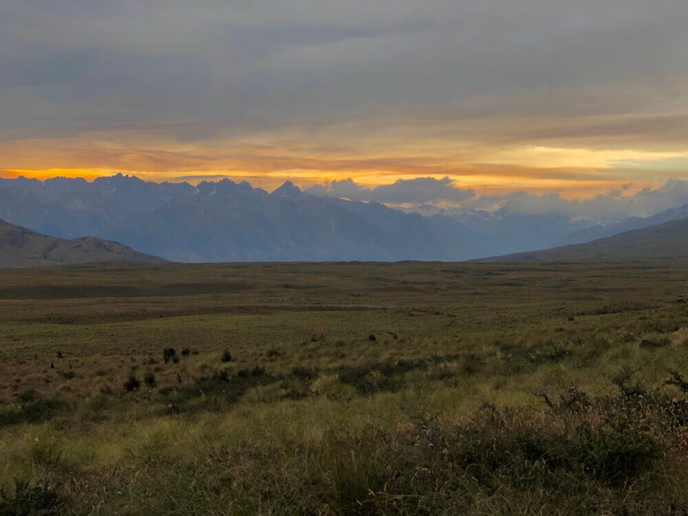
It was a very windy night and we were pretty exposed... I woke up multiple times in the middle of the night to reinforce the tent with my hiking poles, the wind gust made the tent shake as if an earthquake was happening. It wasn’t only windy all night but all day, wind gust that once more moved us around. We were planning to cross the Rangitata River, but the last update I was able to get from cellphone reception about the river flow was a lot higher than the safe crossing flow rate. It was now a day later so things could be better or worst. We decided to do what almost all hikers do; which is to take a shuttle around*. Since the road you meet there is way too quiet for hitchhiking.
*Thx to the 2 hikers that told us what time they were getting picked up.
Day 30 ~ Distance: 11km, Climb: 350m, Cumulative: 806km
Already a month on the trail, time flies! We waited until 10am for the shuttle to come to pick up some hikers that had already made some reservation to see if they still had some space, luckily yes! When we got into cellphone reception I looked at the flow of the river to see how it would have been if we would have crossed, and it was the right decision since it was even stronger. The shuttle brought us to the town of Methven, where he dropped us off for about 4h and picked us up later to drive to the trailhead on the other side of the river. While being in town, we bought fresh food and a bit more food for the upcoming section. By 5 pm we were at the trailhead and it was quite windy again. Luckily the wind was mostly in our back. We climbed over a small pass to camp on the other side for wind protection.
Already a month on the trail, time flies! We waited until 10am for the shuttle to come to pick up some hikers that had already made some reservation to see if they still had some space, luckily yes! When we got into cellphone reception I looked at the flow of the river to see how it would have been if we would have crossed, and it was the right decision since it was even stronger. The shuttle brought us to the town of Methven, where he dropped us off for about 4h and picked us up later to drive to the trailhead on the other side of the river. While being in town, we bought fresh food and a bit more food for the upcoming section. By 5 pm we were at the trailhead and it was quite windy again. Luckily the wind was mostly in our back. We climbed over a small pass to camp on the other side for wind protection.


|
If you want to help me out.
Support this website |
Any questions or comments?
Contact me |
Treks Travels Thoughts is uncopyrighted